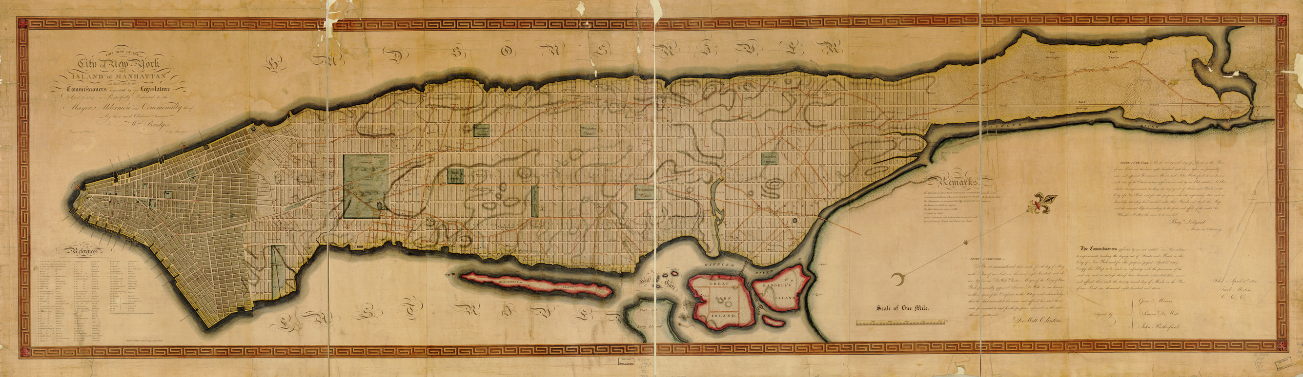
This map is a copy of cartographer and surveyor John Randel’s map of the Commissioners’ Plan of 1811. Paul Knight at The Great American Grid blog explains why a copy was needed:
“The completion of this monumental work [of surveying Manhattan] was no easy task. Surveying an area of 34 square miles would prove difficult enough, but doing so under the threatening eyes of local property owners who did not agree with the survey made it especially hard. For four years Randel and his team experienced a kind of guerrilla warfare as locals ripped up their survey markers and even threw cabbages in protest. But the work was eventually completed and the grand project moved forward.
“[This] map …, however, is not Randel’s plan. It is actually a copy of his work produced by William Bridges in 1814. While Randel was temporarily out of town, Bridges convinced the Common Council to allow him to produce an engraving for dissemination to the public. Randel was not pleased. He accused Bridges of stealing his work, not giving due credit (Randel’s name does not appear anywhere on Bridges’s map), and deceiving the Council. A modern reading of this historical exchange makes it sound like Bridges stole Randel’s work even though technically it was public record. In any case, the Bridges map is a beautiful portrayal of Manhattan’s future.”
Library of Congress Geography and Map Division, g3804n ct000812
http://hdl.loc.gov/loc.gmd/g3804n.ct000812
(Check out the Library of Congress’s website for a super-high—I mean, super-high—resolution version of this map.)
